Occasions & Events
Amsterdam Light Festival Map 2026/27: The Boat Route, Canal by Canal
No official map of the Amsterdam Light Festival boat route exists. The festival's own map covers its roughly 4.5-kilometre walking route, and it only ships inside a paid app from mid-November. A boat cruise sails none of that ground. About 75 minutes on water the walking route never touches. So we measured the loop ourselves, canal by canal, and mapped every departure pier along it.
Is there an official Amsterdam Light Festival map?
Not one that covers a boat. The festival's site lists the Edition 15 dates (26 November 2026 to 17 January 2027) and lighting hours (16:30 to 23:00, 21:00 on 31 December), and nothing else. Their companion app, released mid-November, has the only route map, drawn for people on foot. This page covers what the boats sail instead, canal by canal, with a map of every departure pier.
Walking route and boat cruise are not the same trip
The festival's official walking route is about 4.5 kilometres, roughly 1.5 hours on foot, winding past artwork in windows, under bridges and along the water's edge through the city centre. A Light Festival boat cruise is a different trip. About 75 minutes on the water, the number the festival itself states for a cruise. The two don't add up to each other. Boats can't follow pedestrian stretches, and plenty of the walking route sits nowhere near a canal a tour boat can reach.
What a boat actually sails is a separate question again, and nobody publishes an answer to it. So we measured the loop most Light Festival cruises join ourselves: 11 stretches, 17 bridges and lock-bridges, about 5.1 kilometres. That figure is our own measurement, not something the festival has ever stated. Treat it as a working map, not an official one.
The boat loop, canal by canal
These are the 11 stretches in sailing order, with the bridges you pass under on each. Lengths are rounded to the nearest 10 metres; the whole loop runs 5,070 m. The loop never touches the Jordaan or the Herengracht Golden Bend. It circles the eastern canals around the Plantage and the Oosterdok and closes back onto the Amstel where it began.
- Amstel, 610 m. Under the Blauwbrug (183 m in) and the Magere Brug (516 m in).
- Nieuwe Prinsengracht, 670 m. The Jan Vinckbrug, the Doctor Dunnerbrug and the Ben Polakbrug.
- Plantage Muidergracht, 230 m. The Lau Mazirelbrug.
- Nieuwe Keizersgracht, 510 m. The L.H. Sarlouisbrug and the Dirk van Nimwegenbrug.
- Amstel, 150 m. No bridge.
- Nieuwe Herengracht, 890 m. The Walter Süsskindbrug, the M.S. Vaz Diasbrug, the Hortusbrug and the Latjesbrug.
- Schippersgracht, 190 m. The Scharrebiersluis and the Kortjewantsbrug.
- Oosterdok, 930 m. The Mr. J.J. van der Veldebrug and the Kikkerbilsluis.
- Oudeschans, 520 m. No bridge.
- Sint Antoniesluis, 70 m. No bridge; a sluis is a lock.
- Zwanenburgwal, 300 m. The Ir. B. Bijvoetbrug, after which the loop is back on the Amstel.
The Oosterdok is the longest stretch at 930 m, with the Nieuwe Herengracht next at 890 m. Three stretches pass under no bridge at all: the short second Amstel leg, the Oudeschans and the 70 m Sint Antoniesluis.
The Magere Brug
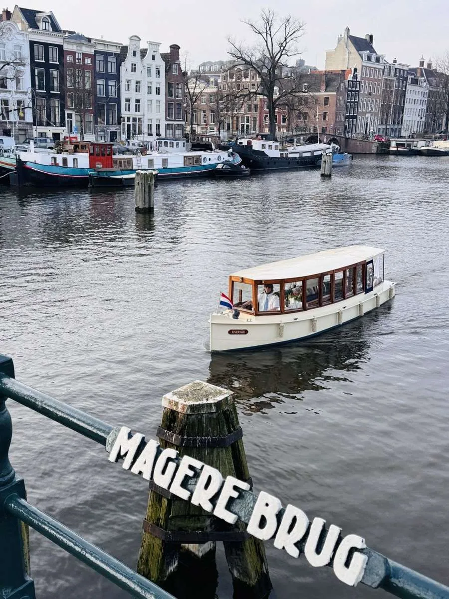
The present Magere Brug dates from 1934, and its last major renovation was in 1969.
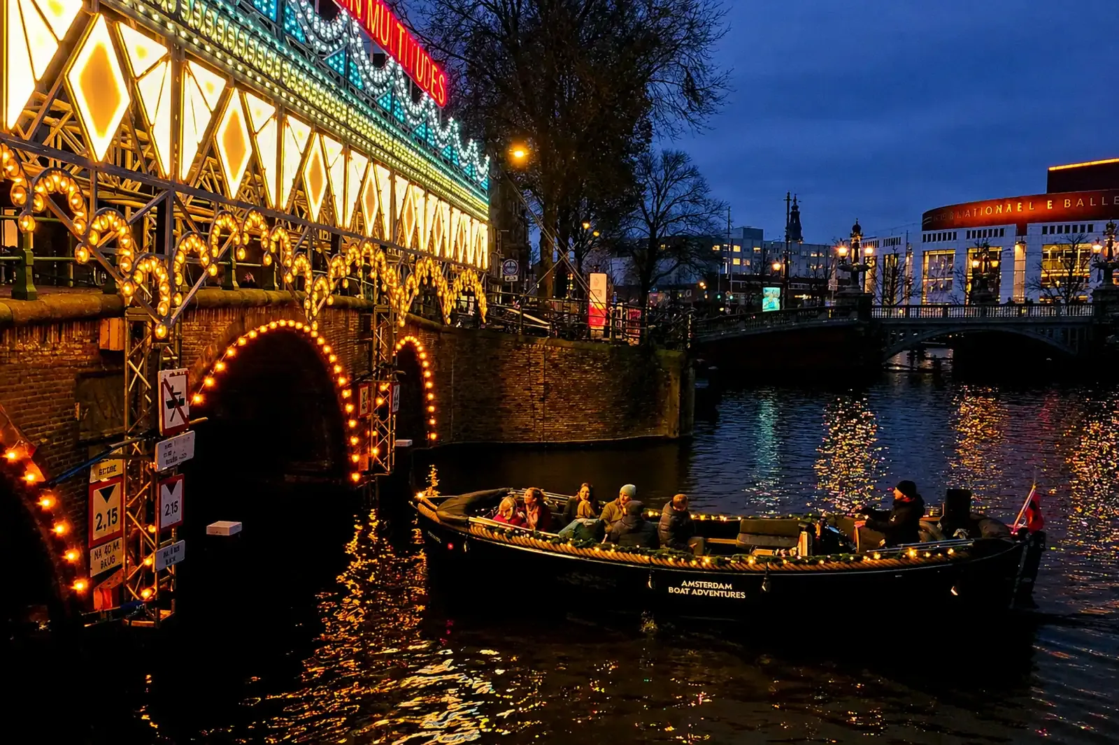
Sail out from the Amstel and the Blauwbrug comes first. The Magere Brug follows 333 m later, lit by roughly 1,200 bulbs after dark. A bridge has stood on that spot since 1691; the one you'd photograph tonight dates from 1934. Its centre section is a bascule bridge: it lifts open on a hinge, and does that several times most days, festival lights or not.
Nieuwe Keizersgracht and the Amstelhof pier
The Nieuwe Keizersgracht is the short eastward tail of the Keizersgracht, cut off from the main canal ring by the Amstel. The Amstelhof, built in 1681, sits between this canal and the Nieuwe Herengracht. It has housed the H'ART Museum since 2009. Only two piers sit directly on the loop's own water: the museum's own dock at Amstel 51, and Nieuwe Keizersgracht 1 itself, where a shared and a private boat both depart.
Nieuwe Herengracht and Nieuwe Prinsengracht: through the Plantage
The Nieuwe Herengracht runs through the Plantage from the Amstel to the Scharrebiersluis, which feeds into the Schippersgracht. The Entrepotdok warehouses sit right beside this stretch. Built between 1708 and 1829 and now apartments, they form the largest inhabited warehouse complex in Amsterdam.
Two bridge names on this stretch carry real history. The Walter Süsskindbrug, a wooden drawbridge, is named for Walter Süsskind, who used his position on the Jewish Council to help save children from deportation during the German occupation. On the Nieuwe Prinsengracht, the Ben Polakbrug carries the Roetersstraat. It honours Ben Polak (1913 to 1993): alderman, doctor and resistance fighter across different decades of his life, not all at once.
Oosterdok to Zwanenburgwal: the old city moat
The Oosterdok is comparatively young water. It was created in 1831 and 1832 by building the Oosterdoksdam and the Oosterdoksluis, and it connects to the Oudeschans through the Kikkerbilsluis, a lock a Rijksmuseum print from around 1913 to 1919 already shows looking much as it does now.
The Zwanenburgwal is older by three centuries. Dug between 1515 and 1518 as the defensive moat along the city's eastern edge, it continues into the Oudeschans, with the Sint Antoniesluis joining the two. The Montelbaanstoren has stood on the Oudeschans bank since 1516, its upper section rebuilt in 1606, marking roughly where the old city wall used to turn.
Three "Keizersgracht" addresses, only one is on the loop
Three festival departure addresses carry the word "Keizersgracht." Only one, Nieuwe Keizersgracht 1, sits on this loop. Keizersgracht 106 and Keizersgracht 196 are on the central canal ring, a different canal roughly a kilometre west. A boat leaving from either one sails the main ring: Herengracht, Prinsengracht, the Golden Bend, not the eastern loop this page maps. Check the house number before you book, not just the street name.
Shared seat or private boat: what the loop costs
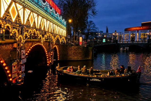
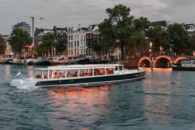
Every boat joins the festival route from its own pier, and no operator states how much of the full loop a given trip actually sails. That leaves price as the fair comparison: per person on a shared boat, per head on a private one, starting from a pier that's genuinely on the loop. Two shared cruises do that: a 24-guest boat from Amstel 51 and a smaller open boat from Nieuwe Keizersgracht 1, both heated.
Which departure pier actually sits on the loop?
Amstel 51 and Nieuwe Keizersgracht 1 stand on the loop's own canals. Amstel 178 sits on the Amstel right next to the loop's first bridge, close but technically off the inner loop. Stationsplein, Keizersgracht 106 and Keizersgracht 196 are off the loop on different canals entirely. The map below pins every departure point; the table after it marks each one and whether its price is charged per person or per boat.

Amsterdam Light Festival - Shared Cruise
€37 pp

Amsterdam Light Festival Cruise on Stan Huygens from H'ART Museum
€52.22 pp

Shared Amsterdam Light Festival Cruise
€29.75 pp

Shared Amsterdam Light Festival Cruise with Hot Chocolate and Stroopwafel
€32 pp

Amsterdam Light Festival Boat Tour 2026
€29.75 pp

Amsterdam Light Festival Cruise with Welcome Snack and (Warm) Drinks (Optional)
€27.5 pp

Luxury Small Group Amsterdam Light Festival Cruise
€49 pp

Amsterdam Light Festival - Shared Tour
€55 pp
Amsterdam Light Festival Boat Tour, 2 Hours, from Keizersgracht 106
€64 pp

Private Amsterdam Light Festival Boat Tour
€320 boat
Amsterdam Light Festival Glow: Private Heated Salon Cruise
€300 boat

Private Amsterdam Light Festival Cruise on a Salon Boat
€320 boat
Departure pier vs the loop
| Departure | Pier vs the loop | Boat | Type and price basis | Heated | Price |
|---|---|---|---|---|---|
| Amstel 51, H'ART Museum | On the loop's canals | Stan Huygens | Shared, per person, 1h30 | Yes | from €52.22 |
| Amstel 51, H'ART Museum dock | On the loop's canals | Heated private salon boat | Private, per boat, 1h15, up to 10 | Yes | from €300 |
| Amstel 51, H'ART Museum pier | On the loop's canals | Private salon boat, 2 hours | Private, per boat, 2h, up to 8 | Yes | from €320 |
| Nieuwe Keizersgracht 1 | On the loop's canals | Shared cruise, open boat | Shared, per person, 1h15 | Yes | from €37 |
| Nieuwe Keizersgracht 1 | On the loop's canals | Private boat tour | Private, per boat, 1h15, up to 12 | Yes | from €320 |
| Amstel 178 | On the Amstel, next to the loop's first bridge | Shared cruise (drinks ticket costs more) | Shared, per person, 1h15 | No | from €29.75 |
| Amstel 178 | On the Amstel, next to the loop's first bridge | Shared cruise with hot chocolate and stroopwafel | Shared, per person, 1h15 | No | from €32 |
| Stationsplein 17 | Off the loop | Boat Tour 2026 | Shared, per person, 70 min | No | from €29.75 |
| Stationsplein 18 | Off the loop | Cruise with optional snack and drinks | Shared, per person, 1h15 | No | from €27.50 |
| Stationsplein 18 | Off the loop | Luxury small group | Shared, per person, 90 min | Yes | from €49 |
| Keizersgracht 106 | Central Keizersgracht, off the loop | Two-hour tour | Shared, per person, 2h | Yes | from €64 |
| Keizersgracht 196 | Central Keizersgracht, off the loop | Shared tour, open boat | Shared, per person, 1h30 | Yes | from €55 |
Private boats that start on the loop
For a group, a private boat from Amstel 51 or Nieuwe Keizersgracht 1 starts on the loop itself. Group sizes and drinks are covered in our company Christmas party boat guide, the Light Festival boat tour overview has the wider picture on timing and boat types, and you can search every Light Festival cruise by date.
Private charters are priced per boat, not per person — the grid compares real prices at your group size.
A solid standard cruise length — good time to relax and soak up the atmosphere. (Exact route depends on departure dock, traffic, and your captain.)
Walking the loop costs nothing, sailing it costs your evening
Walking the loop's canals costs nothing, and on foot you can stop at any artwork for as long as you like. A boat never stops, and anything set back on the far side of a quay can go past unseen from the water. What the boat adds is the view from under the bridges and the canals as one continuous stretch, rather than a series of street crossings. If you want to study the art, walk; if you want the loop as one evening on the water, a boat earns its fare, even though it won't show you everything the walking route does. For a direct side-by-side, see our boat versus walking comparison.
Ready to book your Amsterdam canal cruise?
Compare 80+ vetted boats from local operators — private and shared.
Pick a departure on the loopFrequently Asked Questions
- Not one that covers a boat. The festival's site lists the Edition 15 dates (26 November 2026 to 17 January 2027) and lighting hours, and nothing else. A map ships inside their paid app from mid-November, built for people on foot. This page covers the boat loop instead.
- About 5.1 km by our own measurement, and no, nothing like the walking route. That one runs roughly 4.5 km and about 1.5 hours on foot; a boat covers different water entirely in around 75 minutes.
- In sailing order: the Amstel, Nieuwe Prinsengracht, Plantage Muidergracht, Nieuwe Keizersgracht, the Amstel again, Nieuwe Herengracht, Schippersgracht, Oosterdok, Oudeschans, Sint Antoniesluis and Zwanenburgwal, which closes the loop back on the Amstel.
- Two: Amstel 51 (the H'ART Museum pier) and Nieuwe Keizersgracht 1. Amstel 178 sits right beside the loop's first bridge but is technically off it, and Stationsplein, Keizersgracht 106 and Keizersgracht 196 are on different canals entirely.
- No. The loop stays east, around the Plantage and the Oosterdok, and never reaches the Jordaan or the Herengracht Golden Bend, both well west of this route.
- There isn't a published one. No operator states how much of the full loop their cruise actually covers, so the fairest comparison is price per person from a pier that's genuinely on the route, Amstel 51 or Nieuwe Keizersgracht 1, against private boats priced per head from the same two piers.
Book a Canal Cruise in Amsterdam
Related Guides
- Amsterdam Light Festival: Boat Tour vs. Walking Route (The Honest Verdict)
- Amsterdam Light Festival: Walking Route vs Boat Cruise ComparisonShould you walk the 6.5 km route in winter or view light sculptures from a heated canal boat?
- Amsterdam Light Festival 2026–2027 by Boat: Complete Cruise Guide
- Company Christmas Party Boat at the Amsterdam Light Festival: Let Your Headcount Pick